
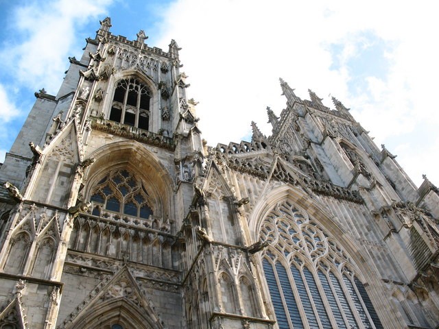
A city at the meeting of two rivers
York stands on the River Ouse, with the smaller Foss joining it near the southern end of the historic centre. Roman, Viking and medieval stories overlap here, but the city is also a place of neighbourhood shops, universities, trades and community groups.
The Minster is a useful landmark for finding your bearings. From there, Petergate leads towards the Shambles and the shopping streets, while Bootham and Gillygate take you beyond the walls into a different part of the city.
More than a day-trip destination
The narrow streets around the Shambles attract visitors, while Fossgate, Walmgate, Micklegate and Bishopthorpe Road have their own mix of independent businesses. Acomb, Clifton, Huntington and the suburbs matter just as much when you are looking for an everyday service.
Chocolate making and the railways are part of York’s identity too. York Cocoa Works on Castlegate and the National Railway Museum give two quite different starting points for exploring those connections.
York and the villages around it
This directory includes York and nearby places such as Haxby, Wigginton, Heslington, Poppleton, Dunnington and Bishopthorpe. Some businesses are based farther out, including Escrick and Gate Helmsley; their addresses remain clear so you can judge the journey.
York is in North Yorkshire geographically, but City of York Council is its own local authority. A nearby village’s postal address can include York without placing it inside the council boundary. Use your postcode when finding the right public service.
Arriving and getting around
York station is close enough to the centre to continue on foot, though the most suitable route depends on your destination and access needs. Park & Ride is another option for arriving by car; check the route, last return bus and current conditions before setting out.
The centre rewards walking, but cobbles, narrow pavements and busy crossings can make a short route less straightforward than a map suggests. Ask individual venues about entrances and step-free access. Riverside paths can close during flooding, so follow local signs rather than treating every waterside route as available.
Spotted something out of date? Let us know.